Trek Route Maps
 Ek Shabda · One Word
 Amar Vani · Eternal Voice
 Boli · Voices of Home
 Naksha · Maps
Three Passes trek map: every stop and pass altitude, 20 days around the Khumbu

On this page
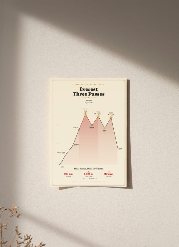
The Three Passes trek map on our print follows a grand loop of the Khumbu, the Everest region of Nepal: about 166 km in 20 days, from Lukla at 2,860 m over Kongma La at 5,535 m, Cho La at 5,420 m and Renjo La at 5,360 m. The print is the trek's own elevation profile stretched full height, with ten stops each marked with its altitude. Below are the stops, the three passes and what the print shows.
What are the stops on the Three Passes trek map?
There are ten stops, in walking order: Lukla, Namche Bazaar, Tengboche, Chukhung, Kongma La, Lobuche, Cho La, Gokyo, Renjo La and Thame. The route starts at Lukla (2,860 m), reaches its highest point at Kongma La (5,535 m) and finishes at Thame (3,800 m).
- Lukla, 2,860 m: the start.
- Namche Bazaar, 3,440 m: up 580 m.
- Tengboche, 3,860 m: up 420 m.
- Chukhung, 4,730 m: up 870 m, the biggest single gain between two stops.
- Kongma La, 5,535 m: up 805 m, the highest of the three passes.
- Lobuche, 4,940 m: down 595 m.
- Cho La, 5,420 m: up 480 m.
- Gokyo, 4,790 m: down 630 m.
- Renjo La, 5,360 m: up 570 m.
- Thame, 3,800 m: down 1,560 m, the biggest drop on the map.
What is the Three Passes trek route?
The route is a loop. It goes from Lukla through Namche Bazaar, Tengboche and Chukhung, over Kongma La, down to Lobuche near Everest Base Camp, over Cho La to the Gokyo valley, and out over Renjo La before dropping back through Thame.
Because it is a loop, the elevation profile is not a single hill. From Lukla it climbs to Chukhung at 4,730 m, then rises and falls three times: up to Kongma La, down to Lobuche, up to Cho La, down to Gokyo, up to Renjo La. Then comes the long final descent to Thame, 1,560 m in one step on our map.
How high are the three passes?
Kongma La is 5,535 m, Cho La is 5,420 m and Renjo La is 5,360 m. Kongma La is the highest of the three and the highest point on our map. We cross-checked these three heights against several current trekking itineraries, and they all gave the same figures.
Kongma La is 115 m above Cho La and 175 m above Renjo La. Between the passes the route drops to Lobuche (4,940 m) and Gokyo (4,790 m), so each pass is followed by a descent of 595 m or 630 m before the next climb begins. Six of the ten stops are above 4,000 m: Chukhung, Kongma La, Lobuche, Cho La, Gokyo and Renjo La.
How many days is the Three Passes trek?
Our map gives the Three Passes trek as 20 days and about 166 km. That is the figure printed on the map. We do not give a day by day itinerary, and the stops above are the outline of the route, not a schedule.
Where is the Three Passes trek in Nepal?
The Three Passes trek is in the Khumbu, the Everest region of Nepal. Our map prints the coordinates 27.9881° N, 86.9250° E, along with the Nepali name of Everest in Devanagari, सगरमाथा (Sagarmatha).
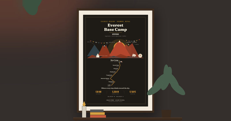
The loop shares ground with two other routes we have mapped. Lukla, Namche Bazaar, Tengboche and Lobuche are also on the Everest Base Camp map, and Gokyo is the lakes stop on the Gokyo Lakes trek map. Cho La is the link between Lobuche and Gokyo.
What is on the Three Passes trek map print?
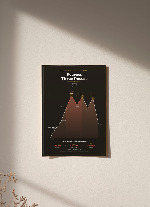
The print is the trek's elevation profile stretched to the full height of the page: a sawtooth of three spikes and two deep drops, one spike for each pass. Every stop is marked with its altitude. Each pass carries a cairn and a string of prayer flags, the technical middle stretch is drawn in crimson, and the print includes ravens.

Because the print is a profile, the valleys are not drawn as a plan view. The footer credits the route data to OpenStreetMap. (Source: © OpenStreetMap contributors.) It comes in a light and a dark version, in 30 x 40, 50 x 70 and 70 x 100 cm, as an unframed fine art print, wood framed or acrylic glass. An unframed 30 x 40 cm print costs €29.95.
The Everest Three Passes print is here in light and dark, and the other routes are in the Trek Route Maps collection.
Questions
Can I use this Three Passes trek map for navigation?
No. It is a decorative wall print showing ten stops and their altitudes. On the trail, carry a proper trekking map or an offline map app.
Which are the three passes?
Kongma La (5,535 m), Cho La (5,420 m) and Renjo La (5,360 m).
How high is the highest point on the Three Passes trek map?
5,535 m, at Kongma La. The trek starts at Lukla, 2,860 m.
Is this a plan view map of the route?
No. It is the trek's elevation profile stretched full height, with one spike for each pass.
Which stops does the Three Passes route share with other treks?
Lukla, Namche Bazaar, Tengboche and Lobuche are also on our Everest Base Camp map, and Gokyo is on our Gokyo Lakes map.
How much does the Three Passes trek map print cost?
From €29.95 for an unframed 30 x 40 cm print. Delivery within the EU is €5.95, free from €40.