Trek Route Maps
 Ek Shabda · One Word
 Amar Vani · Eternal Voice
 Boli · Voices of Home
 Naksha · Maps
Everest Base Camp map: every stop and altitude, Lukla to Base Camp

On this page
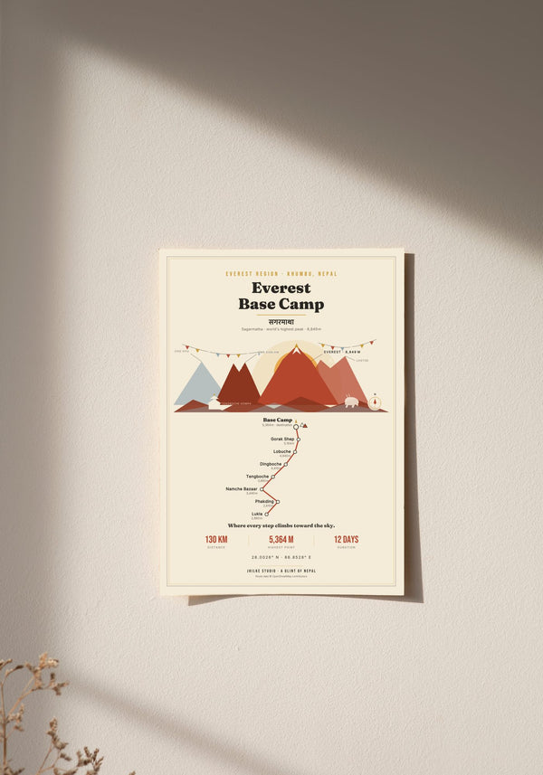
The Everest Base Camp map on our print follows the trail from Lukla at 2,860 m to Everest Base Camp at 5,364 m: about 130 km in 12 days, through eight stops in the Khumbu, the Everest region of Nepal. Below is each stop in walking order with its altitude, where the big climbs are, the peaks on the skyline, and what the print does and does not show.
What are the stops on the Everest Base Camp map?
There are eight stops, in walking order: Lukla, Phakding, Namche Bazaar, Tengboche, Dingboche, Lobuche, Gorak Shep and Everest Base Camp. The route starts at Lukla (2,860 m), drops to Phakding (2,610 m), then climbs at every stop after that until Base Camp at 5,364 m, the highest point on the map.
- Lukla, 2,860 m: the start.
- Phakding, 2,610 m: 250 m lower than Lukla.
- Namche Bazaar, 3,440 m: up 830 m, the biggest single gain on the route.
- Tengboche, 3,860 m: up 420 m.
- Dingboche, 4,410 m: up 550 m, the first stop above 4,000 m.
- Lobuche, 4,940 m: up 530 m.
- Gorak Shep, 5,164 m: up 224 m.
- Everest Base Camp, 5,364 m: up 200 m, the end of the line.
How many days does the Everest Base Camp trek take?
Our map gives the trek as 12 days and about 130 km. In that time the route gains 2,504 m between Lukla and Base Camp, and half of its eight stops sit above 4,000 m: Dingboche, Lobuche, Gorak Shep and Base Camp itself. Treat the figures as the outline printed on the map, not as an itinerary.
The climb is not even. The step from Phakding up to Namche Bazaar is the largest on the map at 830 m. After Namche the gains settle into a run of 420 m to 550 m between stops as far as Lobuche. The last two legs, to Gorak Shep and then to Base Camp, add only about 200 m each, but they are the highest ground of the trek, all above 4,900 m.
Where is Everest Base Camp on the map of Nepal?
Everest Base Camp is in the Khumbu, the Everest region of Nepal, at 5,364 m at the foot of Everest. The walk in starts at Lukla, at 2,860 m. Our map prints the Nepali name of Everest, सगरमाथा (Sagarmatha), in Devanagari, and labels the region "Everest Region, Khumbu, Nepal".
Which mountains can you see on the Everest Base Camp map?
Four peaks are named on the map's skyline: Everest at 8,849 m, Lhotse at 8,516 m, Cho Oyu at 8,188 m and Ama Dablam at 6,812 m. Everest, called Sagarmatha in Nepali, is the highest mountain in the world.
Around the route the print adds prayer flags, a monastery roofline that stands for Tengboche, a grazing yak, a compass and small tents at Base Camp. These are original illustrations of the trail's landmarks rather than copies of any photograph or map.

Is there an Everest Base Camp map PDF?
We do not sell a PDF. Our Everest Base Camp map is a printed wall map that shows eight waypoints and their altitudes, and it is not made for navigation. On the trail, carry a proper trekking map or an offline map app. The route is mapped in OpenStreetMap, which anyone can use with credit.
The stop names and altitudes behind our print come from OpenStreetMap data, and the credit is printed in the footer of every map. (Source: © OpenStreetMap contributors.)
What is on the Everest Base Camp poster?
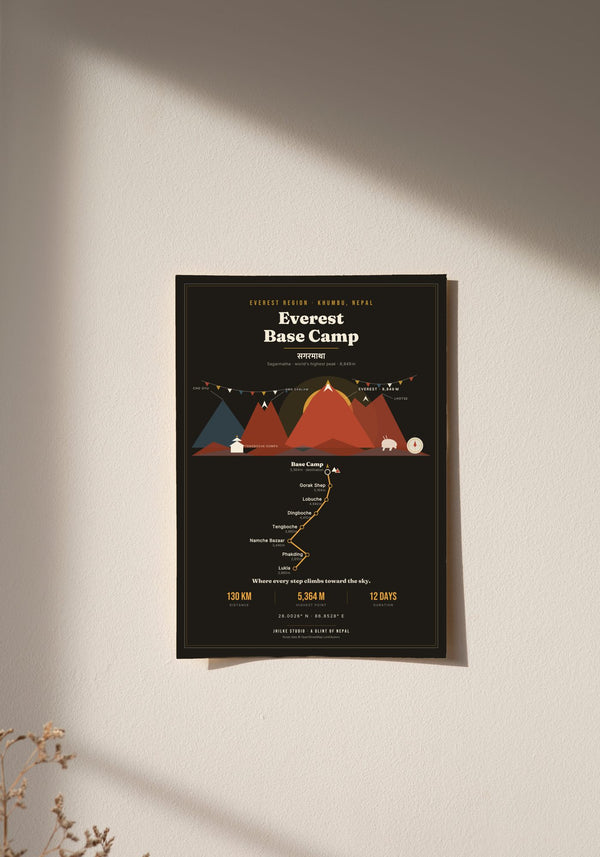
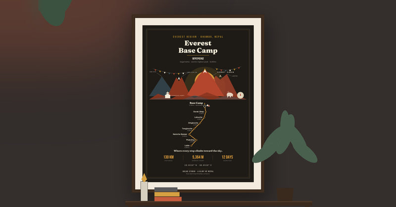
The poster draws the route as one line from Lukla to Base Camp, with each stop marked in walking order and its altitude printed beside it. The stops are placed by trail order, not by height, so Phakding sits after Lukla on the page even though it is 250 m lower.
Every shape on the print is an original design. The light version uses cream, terracotta and gold. The dark version uses deep ink, cream and saffron, for an alpenglow-at-dusk look. Both come in 30 x 40, 50 x 70 and 70 x 100 cm, as an unframed fine art print, wood framed or acrylic glass. An unframed 30 x 40 cm print costs €29.95.
If Everest Base Camp is part of your story, the map is here in light and dark. The other nine routes are in the Trek Route Maps collection, and the Annapurna Circuit map guide covers the other big trek in the same way.
Questions
Can I use this Everest Base Camp map for navigation?
No. It is a decorative wall print showing eight waypoints and their altitudes. Use a trekking map or an offline map app on the trail.
How high is Everest Base Camp?
5,364 m, the highest point on our map. The trek starts at Lukla, 2,860 m.
Which stops on the Everest Base Camp trek are above 4,000 m?
Dingboche (4,410 m), Lobuche (4,940 m), Gorak Shep (5,164 m) and Everest Base Camp (5,364 m).
Is Kala Patthar on the map?
No. Kala Patthar, the viewpoint near Gorak Shep at 5,550 m, is higher than Base Camp. We left it off so the map ends at Base Camp, its highest point.
Why is Phakding drawn after Lukla when it is lower?
The map places stops in the order you walk them, and prints each altitude next to its stop. Phakding (2,610 m) comes after Lukla (2,860 m) on the trail.
How much does the Everest Base Camp map print cost?
From €29.95 for an unframed 30 x 40 cm print. Delivery within the EU is €5.95, free from €40.