Trek Route Maps
 Ek Shabda · One Word
 Amar Vani · Eternal Voice
 Boli · Voices of Home
 Naksha · Maps
Gokyo Lakes trek map: every stop and altitude, Lukla to Gokyo Ri

On this page
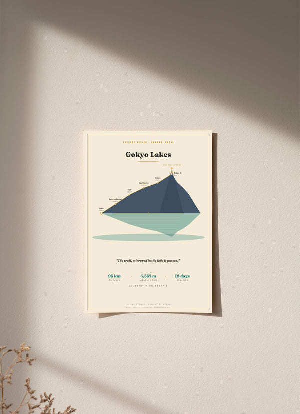
The Gokyo Lakes trek map on our print follows the route from Lukla at 2,860 m up the Dudh Kosi valley to the Gokyo lakes and the viewpoint of Gokyo Ri at 5,357 m: about 95 km, out and back, in 12 days. The print is built around the trek's own elevation profile, with six stops each marked with its altitude. Below is each stop in order, what the print shows and what it leaves out.
What are the stops on the Gokyo Lakes trek map?
There are six stops, in walking order: Lukla, Namche Bazaar, Dole, Machhermo, Gokyo and Gokyo Ri. The route starts at Lukla (2,860 m) and climbs at every stop after it, ending at the Gokyo Ri viewpoint (5,357 m), the highest point on the map.
- Lukla, 2,860 m: the start, at the airstrip.
- Namche Bazaar, 3,440 m: up 580 m.
- Dole, 4,040 m: up 600 m, the biggest single gain on the route and the first stop above 4,000 m.
- Machhermo, 4,470 m: up 430 m.
- Gokyo, 4,790 m: up 320 m, beside the lakes.
- Gokyo Ri, 5,357 m: up 567 m, the view over the lakes with Cho Oyu behind.
How high is the Gokyo Lakes trek?
The highest point on our Gokyo Lakes trek map is Gokyo Ri at 5,357 m. The lakes village of Gokyo sits at 4,790 m, so the viewpoint is 567 m above it. From Lukla to Gokyo Ri the route gains 2,497 m, and four of its six stops are above 4,000 m.
The four stops above 4,000 m are Dole, Machhermo, Gokyo and Gokyo Ri. Behind Gokyo Ri the print draws Cho Oyu, 8,188 m, the sixth-highest mountain in the world. Some sources give Cho Oyu as 8,188 m and others as 8,201 m, and we use 8,188 m on the print.
How many days is the Gokyo Lakes trek?
Our map gives the Gokyo Lakes trek as 12 days and about 95 km, out and back from Lukla. Other itineraries use other day counts. The 12 days is the figure printed on our map, and we do not give a day by day itinerary.
The out and back shape matters for how the print looks. The route climbs from Lukla to Gokyo Ri and returns by the same valley, so the elevation profile is a single rise and fall, and the print mirrors it, as described further down.
Where is the Gokyo Lakes trek in Nepal?
The Gokyo Lakes trek is in the Khumbu, the Everest region of Nepal. It begins at Lukla and goes up the Dudh Kosi valley to the Gokyo lakes. Our map prints the coordinates 27.9519° N, 86.6947° E and labels the region "Everest Region, Khumbu, Nepal".
The lakes are fed by the Ngozumpa Glacier. Six principal lakes are the ones usually named for this trek, while the wider glacial system has about 19 bodies of water. The Ngozumpa is the longest glacier in Nepal and in the Himalaya, about 36 km, flowing from Cho Oyu into the Gokyo valley. (Source: Wikipedia, Gokyo Lakes.)
Does the Gokyo Lakes trek go to Everest Base Camp?
Not on our print, which ends at Gokyo Ri. The Gokyo route and the Everest Base Camp route both start at Lukla and pass through Namche Bazaar. The Three Passes route links Gokyo and Lobuche over Cho La, which is at 5,420 m.
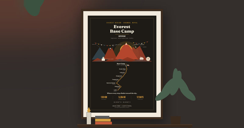
If you want the shared stretch, our Everest Base Camp map guide lists Lukla and Namche Bazaar with their altitudes in the same way, and carries on to the Base Camp trail.
What is on the Gokyo Lakes trek map print?
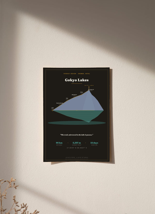
The print draws the trek's own elevation profile, out and back, mirrored across a gold horizon line into a lake below, like the still-water reflection the valley is known for. Every stop is marked with its altitude, from Lukla's airstrip at 2,860 m to the 5,357 m view, with Cho Oyu behind Gokyo Ri.
It is a profile of the climb, so the valleys are not drawn as a plan view. The footer reads "Route, altitude and coordinate data: published trek records". There is no Devanagari on this print. It comes in a light and a dark version, in 30 x 40, 50 x 70 and 70 x 100 cm, as an unframed fine art print, wood framed or acrylic glass. An unframed 30 x 40 cm print costs €29.95.

The map is here in light and dark. The other routes are in the Trek Route Maps collection.
Questions
Can I use this Gokyo Lakes trek map for navigation?
No. It is a decorative wall print showing six stops and their altitudes. On the trail, carry a proper trekking map or an offline map app.
How high is Gokyo Ri?
5,357 m, the highest point on our map. The village of Gokyo below it is at 4,790 m.
Which stops on the Gokyo Lakes trek are above 4,000 m?
Dole (4,040 m), Machhermo (4,470 m), Gokyo (4,790 m) and Gokyo Ri (5,357 m).
Is Cho Oyu on the map?
Yes, as a backdrop peak behind Gokyo Ri, at 8,188 m. Some sources give 8,201 m, and we use 8,188 m.
Is this a plan view map of the lakes?
No. It is the trek's elevation profile, out and back, mirrored across a gold horizon line into a lake below.
How much does the Gokyo Lakes trek map print cost?
From €29.95 for an unframed 30 x 40 cm print. Delivery within the EU is €5.95, free from €40.