Trek Route Maps
 Ek Shabda · One Word
 Amar Vani · Eternal Voice
 Boli · Voices of Home
 Naksha · Maps
Langtang trek map: every stop and altitude, Syabrubesi to Tserko Ri

On this page
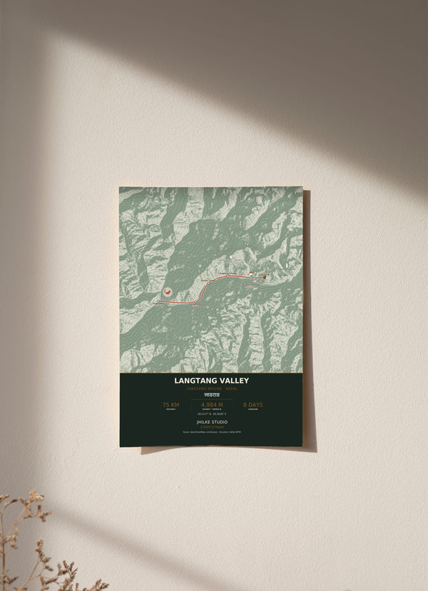
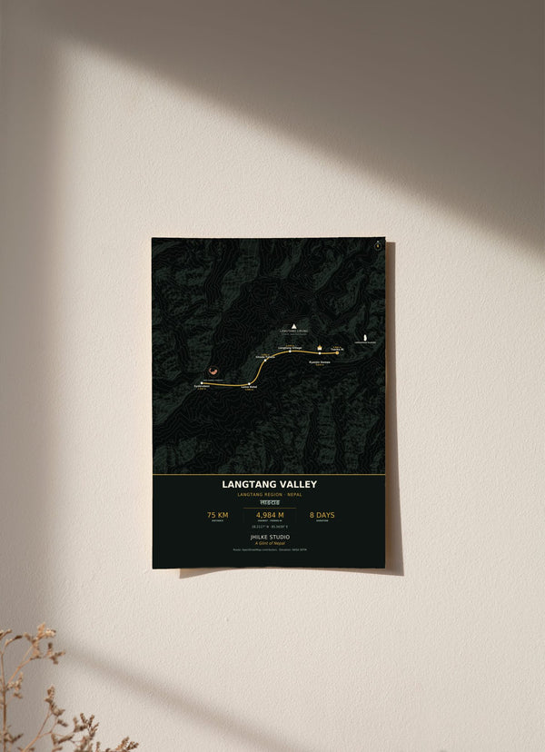
The Langtang trek map on our print follows the trail from Syabrubesi at 1,550 m to Tserko Ri at 4,984 m: about 75 km in 8 days, through six stops in the Langtang region of Rasuwa, Nepal. It is an eight day walk up a single forested valley. Below is each stop in walking order with its altitude, the peaks on the print, and what the map does and does not show.
What are the stops on the Langtang trek map?
There are six stops, in walking order: Syabrubesi, Lama Hotel, Ghoda Tabela, Langtang Village, Kyanjin Gompa and Tserko Ri. The route starts at Syabrubesi (1,550 m) and climbs at every stop after that, ending at Tserko Ri, 4,984 m, the highest point on the map.
- Syabrubesi, 1,550 m: the start.
- Lama Hotel, 2,480 m: up 930 m.
- Ghoda Tabela, 3,000 m: up 520 m.
- Langtang Village, 3,430 m: up 430 m.
- Kyanjin Gompa, 3,870 m: up 440 m.
- Tserko Ri, 4,984 m: up 1,114 m, the biggest single gain on the route.
Is there a Langtang trek map with distance?
Our map gives the trek as about 75 km in 8 days. We do not print a distance for each stop, only the altitude beside it. In that time the route gains 3,434 m between Syabrubesi and Tserko Ri, and only the last stop, Tserko Ri, is above 4,000 m.
The climb comes in two big steps. The first is 930 m from Syabrubesi up to Lama Hotel. After that the gains settle into a run of 430 m to 520 m between stops as far as Kyanjin Gompa. The last step, from Kyanjin Gompa up to Tserko Ri, is the largest at 1,114 m. Treat the figures as the outline printed on the map, not as an itinerary.
What is the Langtang trek route from Kathmandu?
We do not print how far Langtang is from Kathmandu or how to get there. The walk on our map starts at Syabrubesi, 1,550 m, and runs up the valley to Kyanjin Gompa and then Tserko Ri.
Along the way the route climbs from the terraced fields at Syabrubesi through rhododendron and fir forest, red panda country, to the yak pastures and the Tamang gompa at Kyanjin. From Kyanjin it goes up to Tserko Ri for a full circle of Langtang Lirung and the glacier valleys beyond.
Where is Langtang on the map of Nepal?
Langtang is in the Langtang region of Rasuwa, Nepal. The walk goes up one valley, from Syabrubesi at 1,550 m to Kyanjin Gompa at 3,870 m. Our map prints the name in Devanagari, लाङटाङ, and the coordinates 28.2117° N, 85.5639° E, near Kyanjin Gompa and the Kyanjin viewpoint.
Two features are marked beyond the stops. Langtang Lirung, at 7,234 m, sits at its summit position with the caption "seen from Kyanjin". Langshisha Glacier is marked beyond Kyanjin Gompa.

Can I use Google Maps for the Langtang trek map?
We cannot speak for what any app shows. Our Langtang trek map is a printed wall map with six stops and their altitudes, and it is not made for navigation. On the trail, carry a proper trekking map or an offline map app.
The route behind our print comes from OpenStreetMap, and the terrain comes from NASA SRTM elevation data. The footer of the print credits both. (Sources: © OpenStreetMap contributors; NASA SRTM.)
What is on the Langtang trail map print?
The print is a full bleed plan view map built from real elevation data: NASA SRTM terrain, with contour lines every 400 m. The six stops are geocoded from OpenStreetMap, and the altitude of each is printed beside it.
The light version is a forest map in cream, teal, gold and sage. Both versions come in 30 x 40, 50 x 70 and 70 x 100 cm, as an unframed fine art print, wood framed or acrylic glass. An unframed 30 x 40 cm print costs €29.95.
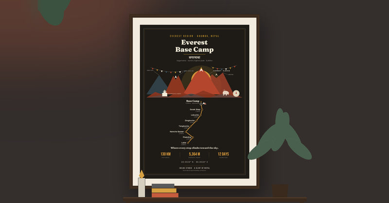
If Langtang is part of your story, the map is here in light and dark. The other trek routes are in the Trek Route Maps collection, and the Everest Base Camp map guide covers another route in the same way.
Questions
Can I use this Langtang trek map for navigation?
No. It is a decorative wall print showing six stops and their altitudes. Use a trekking map or an offline map app on the trail.
How high is Tserko Ri?
4,984 m, the highest point on our map. The walk starts at Syabrubesi, 1,550 m.
How long is the Langtang trek on the map?
About 75 km in 8 days, as printed on the map. Per stop distances are not printed.
Which mountain is marked on the Langtang trek map?
Langtang Lirung, 7,234 m, marked at its summit position with the caption "seen from Kyanjin". Langshisha Glacier is marked beyond Kyanjin Gompa.
Where does the Langtang walk on the map start?
At Syabrubesi, 1,550 m. We do not print how to get there from Kathmandu.
How much does the Langtang trek map print cost?
From €29.95 for an unframed 30 x 40 cm print. Delivery within the EU is €5.95, free from €40.