Trek Route Maps
 Ek Shabda · One Word
 Amar Vani · Eternal Voice
 Boli · Voices of Home
 Naksha · Maps
Annapurna Base Camp map: every stop and altitude, Nayapul to Base Camp

On this page
- What are the stops on the Annapurna Base Camp map?
- How long is the trek, and is there an Annapurna Base Camp map with distance?
- Where is Annapurna Base Camp, and what are the directions?
- Which mountains surround Annapurna Base Camp on the map?
- Is there an Annapurna Base Camp map PDF?
- What is on the Annapurna Base Camp map poster?
- Questions
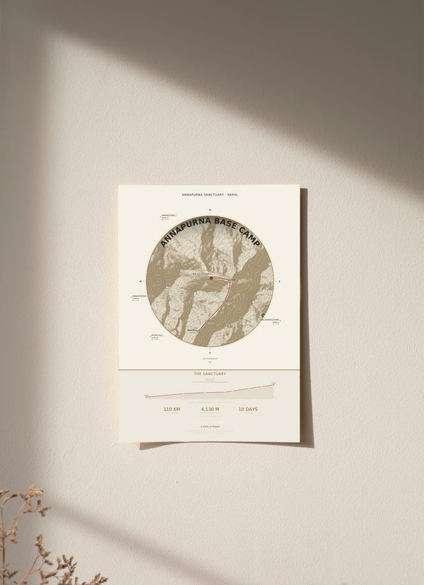
The Annapurna Base Camp map on our print follows the trail from Nayapul at 1,070 m to Annapurna Base Camp at 4,130 m: about 110 km in 10 days, through eight stops in the Annapurna Sanctuary, Nepal. Below is each stop in walking order with its altitude, the peaks around Base Camp, and what the print does and does not show.
What are the stops on the Annapurna Base Camp map?
There are eight stops, in walking order: Nayapul, Ghandruk, Chhomrong, Bamboo, Dovan, Deurali, Machhapuchhre Base Camp (MBC) and Annapurna Base Camp (ABC). The route starts at Nayapul (1,070 m) and rises at every stop, ending at Annapurna Base Camp at 4,130 m, the highest point on the map.
- Nayapul, 1,070 m: the start.
- Ghandruk, 1,940 m: 870 m higher than Nayapul, the biggest single step on the route.
- Chhomrong, 2,170 m: 230 m higher.
- Bamboo, 2,310 m: 140 m higher, the smallest step.
- Dovan, 2,600 m: 290 m higher.
- Deurali, 3,230 m: 630 m higher, the first stop above 3,000 m.
- Machhapuchhre Base Camp (MBC), 3,700 m: 470 m higher.
- Annapurna Base Camp (ABC), 4,130 m: 430 m higher, the end of the line.
How long is the trek, and is there an Annapurna Base Camp map with distance?
Our map gives the trek as about 110 km in 10 days. That total is the only distance printed. The map does not show the distance between stops. What it does show is the altitude beside each stop and an ascent profile ribbon, so you can read the climb stop by stop.
Between Nayapul and Annapurna Base Camp the printed altitudes rise by 3,060 m. Three of the eight stops sit above 3,000 m: Deurali, Machhapuchhre Base Camp and Base Camp itself. Only Base Camp is above 4,000 m. Those figures are the differences between the altitudes printed on the map, not an itinerary.
Where is Annapurna Base Camp, and what are the directions?
Annapurna Base Camp is in the Annapurna Sanctuary, Nepal, at 4,130 m. The coordinates printed on our map are 28.5308° N, 83.8779° E. The walk in starts at Nayapul, at 1,070 m, and follows the stops listed above. The map prints the Nepali name अन्नपूर्ण (Annapurna) in Devanagari.
The trail reaches Base Camp by way of the Modi Khola valley. The peaks stand around Base Camp on three sides like an amphitheatre, and the bowl is open only where that valley lets the trail in.
Which mountains surround Annapurna Base Camp on the map?
Four peaks are placed on the map at their compass bearing and distance from Base Camp: Annapurna I at 8,091 m (northwest, 9.2 km), Annapurna South at 7,219 m (west, 7.1 km), Hiunchuli at 6,441 m (southwest, 3.4 km) and Machhapuchhre, also called Fishtail, at 6,993 m (southeast, 7.6 km).
Hiunchuli is the closest of the four, at 3.4 km, and Annapurna I is the farthest and the highest, at 9.2 km and 8,091 m. Seen together they explain the amphitheatre shape: three peaks to the northwest, west and southwest, and Machhapuchhre to the southeast.

Is there an Annapurna Base Camp map PDF?
We do not sell a PDF. Our Annapurna Base Camp map is a printed wall map with eight stops and their altitudes, and it is not made for navigation. On the trail, carry a proper trekking map or an offline map app.
The stop positions on our print come from OpenStreetMap, and the terrain comes from NASA SRTM elevation data. The footer of the map credits both. (Sources: © OpenStreetMap contributors; NASA SRTM.)
What is on the Annapurna Base Camp map poster?
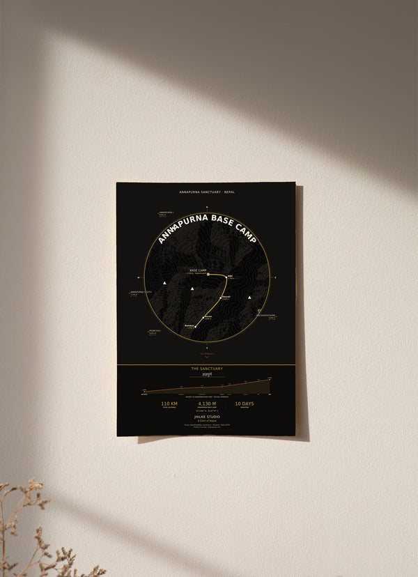
The poster is a circular medallion map built from real elevation data. The terrain is from NASA SRTM, with contour lines every 300 m, and each stop is marked with its altitude beside it. An ascent profile ribbon traces the climb, with the altitude of each stop labelled.
The four peaks sit around the medallion at their compass bearing from Base Camp, and the coordinates are printed on the map. The light version uses cream, terracotta and gold. Both versions come in 30 x 40, 50 x 70 and 70 x 100 cm, as an unframed fine art print, wood framed or acrylic glass. An unframed 30 x 40 cm print costs €29.95.
If Annapurna Base Camp is part of your story, the map is here in light and dark. The other routes are in the Trek Route Maps collection, and the Annapurna Circuit map guide covers the other big trek in the same region.
Questions
Can I use this Annapurna Base Camp map for navigation?
No. It is a decorative wall print showing eight stops and their altitudes. Use a trekking map or an offline map app on the trail.
How high is Annapurna Base Camp?
4,130 m, the highest point on our map. The trek starts at Nayapul, 1,070 m.
Does the map show distances between stops?
No. It prints the total, about 110 km, and the altitude of each stop. It does not print the distance from one stop to the next.
Which stops on the trek are above 3,000 m?
Deurali (3,230 m), Machhapuchhre Base Camp (3,700 m) and Annapurna Base Camp (4,130 m).
Is Poon Hill on the map?
No. Poon Hill is not one of the eight stops on this print. We made a separate map for it, the Ghorepani Poon Hill print.
How much does the Annapurna Base Camp map print cost?
From €29.95 for an unframed 30 x 40 cm print. Delivery within the EU is €5.95, free from €40.